
Fai una donazione
Preparati per la tua prossima avventura:
In qualità di associato Amazon, questo sito riceve una commissione sugli acquisti idonei senza alcun costo aggiuntivo per te.
Mappa topografica Morningside Park
Clicca sulla mappa per visualizzare l'altitudine.
Fai una donazione
Preparati per la tua prossima avventura:
In qualità di associato Amazon, questo sito riceve una commissione sugli acquisti idonei senza alcun costo aggiuntivo per te.
Morningside Park
Dutch settlers occupied Manhattan in the early 17th century and called the area around Morningside Park Vredendal, meaning 'peaceful dale'. The lowlands to the east were called Flacken by the Dutch, and were later translated to "Flats" in English. The land to the east was not settled initially because of its marshy topography. The area became known as Montagne's (or Montayne's) Flat after Johannes de la Montagne, who was among the first European settlers of New Harlem in 1658; he owned about 200 acres (81 ha) between what is now 109th and 124th Streets. The western boundary of the area was the cliff, while the eastern boundary was a creek that emptied east into the East River. Montagne's Flat was subdivided into lots in 1662, and four years later a new charter for New Harlem was given to the English, who had seized New Netherland, renaming it New York. Through the 17th and 18th centuries, the cliff formed a geopolitical boundary between Harlem to the east and the heights to the west.
Fai una donazione
Preparati per la tua prossima avventura:
In qualità di associato Amazon, questo sito riceve una commissione sugli acquisti idonei senza alcun costo aggiuntivo per te.
A proposito di questa mappa
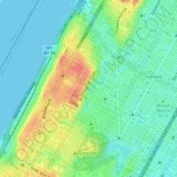
Nome: Mappa topografica Morningside Park, altitudine, rilievo.
Altitudine media: 20 m
Altitudine minima: 0 m
Altitudine massima: 61 m
Fai una donazione
Preparati per la tua prossima avventura:
In qualità di associato Amazon, questo sito riceve una commissione sugli acquisti idonei senza alcun costo aggiuntivo per te.
Altre mappe topografiche
Clicca su una mappa per visualizzarne la topografia, l'altitudine e il rilievo.
Highbridge Park
United States > New York > New York County > New York
The north and south wings respectively contain the women's and men's locker rooms and are nearly identical. Both have nine windows separated by eight brick pilasters. The stone capitals of the pilasters line up with the lintels of the windows. Ramps lead from the extreme ends of each wing. The ground slopes…
Altitudine media: 30 m
Fort Tryon Park
United States > New York > New York County > New York
In preparation for converting the land into a city park, Rockefeller hired the Olmsted Brothers firm, particularly Frederick Law Olmsted Jr., son of the designer of Central Park. Olmsted's design capitalized on the topography to reveal sweeping vistas of the Hudson River and the Palisades. Olmsted Jr. was…
Altitudine media: 20 m
Fai una donazione
Preparati per la tua prossima avventura:
In qualità di associato Amazon, questo sito riceve una commissione sugli acquisti idonei senza alcun costo aggiuntivo per te.