
Fai una donazione
Preparati per la tua prossima avventura:
In qualità di associato Amazon, questo sito riceve una commissione sugli acquisti idonei senza alcun costo aggiuntivo per te.
Mappa topografica Oyster Point
Clicca sulla mappa per visualizzare l'altitudine.
Fai una donazione
Preparati per la tua prossima avventura:
In qualità di associato Amazon, questo sito riceve una commissione sugli acquisti idonei senza alcun costo aggiuntivo per te.
A proposito di questa mappa
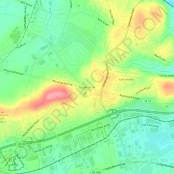
Nome: Mappa topografica Oyster Point, altitudine, rilievo.
Altitudine media: 140 m
Altitudine minima: 99 m
Altitudine massima: 205 m
Fai una donazione
Preparati per la tua prossima avventura:
In qualità di associato Amazon, questo sito riceve una commissione sugli acquisti idonei senza alcun costo aggiuntivo per te.
Altre mappe topografiche
Clicca su una mappa per visualizzarne la topografia, l'altitudine e il rilievo.
Fai una donazione
Preparati per la tua prossima avventura:
In qualità di associato Amazon, questo sito riceve una commissione sugli acquisti idonei senza alcun costo aggiuntivo per te.
Willow Street
United States > Pennsylvania > Lancaster County > West Lampeter Township
Pennsylvania Route 272 (Willow Street Pike) is the main highway through the community. It is split into two one-way streets, with the northbound lanes following the original main street through the town, and the southbound lanes running four blocks to the west. PA 272 leads north 4 miles (6 km) to the center…
Altitudine media: 119 m
Fai una donazione
Preparati per la tua prossima avventura:
In qualità di associato Amazon, questo sito riceve una commissione sugli acquisti idonei senza alcun costo aggiuntivo per te.
Indian Rocks
United States > Pennsylvania > Lancaster County > East Cocalico Township
Altitudine media: 161 m
Gap
United States > Pennsylvania > Lancaster County
Gap is in eastern Lancaster County, in the southern part of Salisbury Township. A small portion of the community extends south into Sadsbury Township. The gap for which the community is named is at an elevation of 580 feet (180 m) above sea level, between Mine Ridge to the west and Gap Hill to the east, both…
Altitudine media: 169 m
Paradise
United States > Pennsylvania > Lancaster County > Paradise Township > Paradise
Altitudine media: 122 m
Fai una donazione
Preparati per la tua prossima avventura:
In qualità di associato Amazon, questo sito riceve una commissione sugli acquisti idonei senza alcun costo aggiuntivo per te.