
Mappa topografica Llangorse Lake
Mappa interattiva
Clicca sulla mappa per visualizzare l'altitudine.
Llangorse Lake
The lake is a Site of Special Scientific Interest (SSSI) and has long been regarded as a place where fish and birds are found in unusually high numbers. Gerald of Wales (Giraldus Cambrensis) mentioned the abundance of waterfowl in his topographical work, The Description of Wales in the 12th century. It is a Special Area of Conservation (under the EU Habitats Directive) as an example of a natural nutrient-rich lake with pondweeds.
A proposito di questa mappa
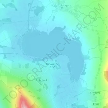
Nome: Mappa topografica Llangorse Lake, altitudine, rilievo.
Luogo: Llangorse Lake, Llangors, Powys, Wales, United Kingdom (51.92203 -3.27606 51.93548 -3.25056)
Altitudine media: 177 m
Altitudine minima: 150 m
Altitudine massima: 327 m