
Mappa topografica Tangail
Mappa interattiva
Clicca sulla mappa per visualizzare l'altitudine.
Tangail
Tangail was a popular local business centre since the early 19th century. But the name came on focus when the headquarter of a subdivision of the Greater Mymensingh District was shifted in 1860 from Atia to there due to its fertility and high elevation near Louhajong River. At the same time, The subdivision was named as Tangail.
A proposito di questa mappa
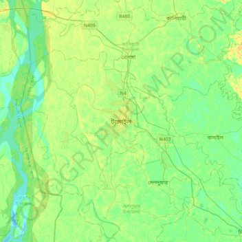
Nome: Mappa topografica Tangail, altitudine, rilievo.
Altitudine media: 11 m
Altitudine minima: 2 m
Altitudine massima: 24 m