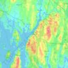
Mappa topografica Fall River
Clicca sulla mappa per visualizzare l'altitudine.
Fall River
Fall River was the only city on the East Coast of the United States to have had an exposed waterfall in part of its downtown area; it flowed less than 1⁄2 mile (0.8 km) into a sheltered harbor at the edge of downtown. Fall River has two large lakes (originally one lake) and a large portion of protected woodlands on the eastern part of the city, which is higher in elevation, with the Quequechan River draining out of the ponds and flowing 2.5 miles (4.0 km) through the heart of the city, emptying out an estimated 26 million US gallons (98×10^6 l) per day into the deep Mount Hope Bay/Taunton River estuary in the western part of the city.
A proposito di questa mappa
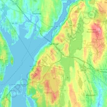
Nome: Mappa topografica Fall River, altitudine, rilievo.
Luogo: Fall River, Bristol County, Massachusetts, United States (41.60368 -71.20131 41.76898 -71.00954)
Altitudine media: 32 m
Altitudine minima: -5 m
Altitudine massima: 105 m
Altre mappe topografiche
Clicca su una mappa per visualizzarne la topografia, l'altitudine e il rilievo.

Leonard and Marydee Flynn Cons Area
United States > Massachusetts > Bristol County > Mansfield
Altitudine media: 39 m




Quincy Street
United States > Massachusetts > Bristol County > Fairhaven > Oxford
Altitudine media: 13 m



Daley Corner
United States > Massachusetts > Bristol County > Easton > North Easton
Altitudine media: 47 m

Source Is Shapefile From Town
United States > Massachusetts > Bristol County > Mansfield > Robinsonville
Altitudine media: 50 m