
Mappa topografica Château-Renault
Mappa interattiva
Clicca sulla mappa per visualizzare l'altitudine.
A proposito di questa mappa
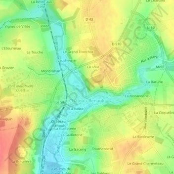
Nome: Mappa topografica Château-Renault, altitudine, rilievo.
Altitudine media: 112 m
Altitudine minima: 83 m
Altitudine massima: 141 m
Château-Renault is located on the Far-West of the Gâtine Tourangelle plateau, next to the Loir-et-Cher department and at the confluence of two rivers. The Gault and the Brenne. Its Elevation vary between 90 meters and 140 meters on the plateau. The area of the commune is 3.51 square kilometre.