
Mappa topografica Barajevo
Mappa interattiva
Clicca sulla mappa per visualizzare l'altitudine.
A proposito di questa mappa
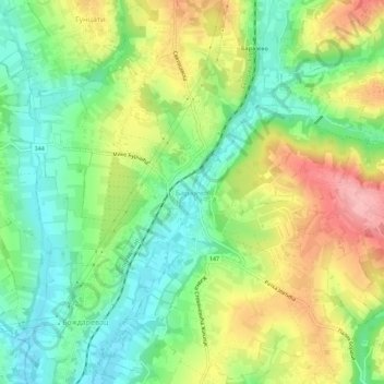
Nome: Mappa topografica Barajevo, altitudine, rilievo.
Altitudine media: 175 m
Altitudine minima: 116 m
Altitudine massima: 261 m
The municipality is located in the lower northern part of Šumadija, southeast of the Belgrade, with an elevation spanning from 140 meters to 364 meters. Most of the municipal territory belongs to the drainage area of the Turija river, right tributary of the Peštan river, which in turn flows into the Kolubara, thus whole area geographically gravitates to the Kolubara region. The cultural festival, "Barlet" (Barajevo summer) is held annually in Barajevo.