

Mappa topografica Koloriang
Clicca sulla mappa per visualizzare l'altitudine.
Koloriang
Koloriang is a hilly district headquarters town of Kurung Kumey district in Arunachal Pradesh, India, bordering Tibet. It has an altitude of 1,000 metres (3,300 ft) and is surrounded by high mountains all around and is located in the right bank of river Kurung, one of the major tributaries of Subansiri river. The climate is rainy and hot during summer and very cold in winter. Located at an altitude of 1,040 metres above sea level, this town is also an old administrative centre. It is about 257 km from state capital, Itanagar.
A proposito di questa mappa
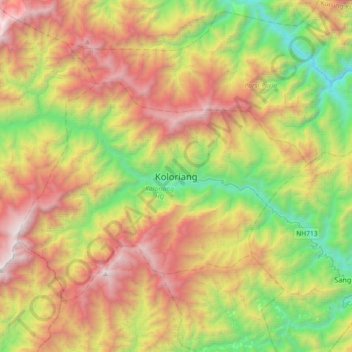
Nome: Mappa topografica Koloriang, altitudine, rilievo.
Altitudine media: 1.791 m
Altitudine minima: 498 m
Altitudine massima: 3.508 m