
Mappa topografica Theodore Roosevelt National Park
Mappa interattiva
Clicca sulla mappa per visualizzare l'altitudine.
Theodore Roosevelt National Park
The wilderness protects from development the wildest sections of the National Park, an area described as badlands where erosional forces have carved steep cliffs into the relatively flat prairie. Bison, pronghorn, elk, mule deer and coyote are all found here, along with hundreds of species of birds such as the bald eagle, falcon and hawk. The wilderness is separated into two sections along with the park, a north and a south unit, by a distance of 70 miles (110 km). The Little Missouri River is on the south side of both units and is credited for being the primary erosional source which created the badlands topography.
A proposito di questa mappa
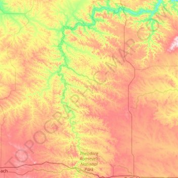
Nome: Mappa topografica Theodore Roosevelt National Park, altitudine, rilievo.
Altitudine media: 756 m
Altitudine minima: 573 m
Altitudine massima: 1.000 m