
Mappa topografica Vinkovci
Mappa interattiva
Clicca sulla mappa per visualizzare l'altitudine.
A proposito di questa mappa
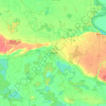
Nome: Mappa topografica Vinkovci, altitudine, rilievo.
Luogo: Vinkovci, Grad Vinkovci, Vukovar-Srijem County, 32100, Croatia (45.24793 18.76263 45.32793 18.84263)
Altitudine media: 89 m
Altitudine minima: 75 m
Altitudine massima: 106 m
Vinkovci is located in the eastern part of the Slavonia region, 19 km (12 mi) southwest of Vukovar, 24 km (15 mi) north of Županja and 43 km (27 mi) south of Osijek. The city lies in a flatland on the Bosut river, at an elevation of approx. 90 metres (300 ft), and has a mild continental climate. Vinkovci is also part of the smaller subregion of Syrmia.