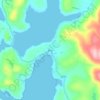
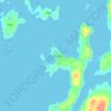
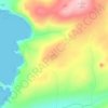
Mappa topografica Housay
Clicca sulla mappa per visualizzare l'altitudine.
Housay
Being so close to Norway, the islands were of strategic importance in World War II and were a regular landfall for Norwegian boats carrying escapees from the Nazi occupation. The local coastguard was responsible for the refugees, and at one point during the war were issued with a tommy gun, although initially no-one knew how to use it. German planes frequently flew over at low altitudes, strafing the Grunay lighthouse shore station in 1941 and dropping a bomb in 1942. The latter attack killed Mary Anderson, the only local casualty of the war, and Grunay was evacuated soon afterwards. A month later a Canadian bomber crashed on Grunay, and in 1990 a plaque was raised to commemorate that event. Dey (1991) states that the bomber was a "British" Blenheim bomber with a crew of two Canadians and one Englishman. The plaque ceremony was attended by the family of F/Sgt Jay Oliver, one of the two Canadian casualties, and Peter Johnson, a local man who had witnessed the crash aged eight years. During the war an official letter was sent in secret to the local sub-postmistress with instructions that it be opened in the event of a German invasion. After the war it was returned, unopened.
A proposito di questa mappa

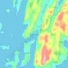
Nome: Mappa topografica Housay, altitudine, rilievo.
Luogo: Housay, Skerries, Shetland, Scotland, United Kingdom (60.40947 -0.79909 60.43211 -0.75373)
Altitudine media: 3 m
Altitudine minima: -1 m
Altitudine massima: 46 m
Altre mappe topografiche
Clicca su una mappa per visualizzarne la topografia, l'altitudine e il rilievo.

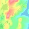





Ronas Hill
United Kingdom > Scotland > Shetland
Ronas Hill (or Rönies Hill) is a hill in Shetland, Scotland. It is classed as a Marilyn, and is the highest point in the Shetland Islands at an elevation of 450 m (1,480 ft). A Neolithic chambered cairn is located near the summit.
Altitudine media: 298 m