
Mappa topografica Glasgow
Clicca sulla mappa per visualizzare l'altitudine.
Glasgow
Glasgow itself was reputed to have been founded by the Christian missionary Saint Mungo in the 6th century. He established a church on the Molendinar Burn, where the present Glasgow Cathedral stands, and in the following years Glasgow became a religious centre. Glasgow grew over the following centuries. The Glasgow Fair reportedly began in 1190. The first bridge over the River Clyde at Glasgow was recorded from around 1285, giving its name to the Briggait area of the city, forming the main north–south route over the river via Glasgow Cross. The founding of the University of Glasgow in 1451 and elevation of the bishopric to become the Archdiocese of Glasgow in 1492 increased the town's religious and educational status and landed wealth. Its early trade was in agriculture, brewing and fishing, with cured salmon and herring being exported to Europe and the Mediterranean.
A proposito di questa mappa
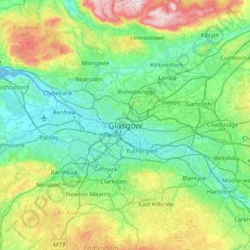
Nome: Mappa topografica Glasgow, altitudine, rilievo.
Luogo: Glasgow, Glasgow City, Scotland, G2 1AL, United Kingdom (55.70116 -4.41017 56.02116 -4.09017)
Altitudine media: 128 m
Altitudine minima: -5 m
Altitudine massima: 554 m
Altre mappe topografiche
Clicca su una mappa per visualizzarne la topografia, l'altitudine e il rilievo.