
Mappa topografica Gatton
Mappa interattiva
Clicca sulla mappa per visualizzare l'altitudine.
A proposito di questa mappa
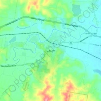
Nome: Mappa topografica Gatton, altitudine, rilievo.
Altitudine media: 115 m
Altitudine minima: 87 m
Altitudine massima: 196 m
The area has a humid subtropical climate, with hot, humid summers and mild, sunny winters. Heavy summer rain and warm conditions have provided ideal conditions for the areas agricultural productivity, although droughts and heatwaves can be problematic at times. Temperatures in Gatton are among the warmest in south-east Queensland in summer due to its position away from the coast but at low elevation in the Brisbane Valley.