
Mappa topografica Stonewall
Mappa interattiva
Clicca sulla mappa per visualizzare l'altitudine.
A proposito di questa mappa
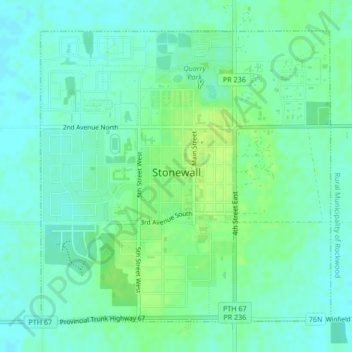
Nome: Mappa topografica Stonewall, altitudine, rilievo.
Luogo: Stonewall, Division No. 14, Manitoba, R0C 2Z0, Canada (50.12275 -97.34503 50.14507 -97.31026)
Altitudine media: 251 m
Altitudine minima: 245 m
Altitudine massima: 259 m
When the last ice age retreated, as well as the prairies, escarpments such as Riding Mountain were left behind. In addition to these, smaller elevations were left behind such as Stony Mountain and Stonewall. It is believed that these escarpments were used as look-outs by early hunters approximately 4,000 to 5,000 years ago. These formations were later used as buffalo jumps by the indigenous populations.