
Mappa topografica Abrantes
Mappa interattiva
Clicca sulla mappa per visualizzare l'altitudine.
A proposito di questa mappa
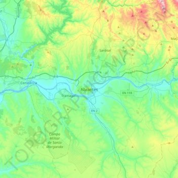
Nome: Mappa topografica Abrantes, altitudine, rilievo.
Altitudine media: 162 m
Altitudine minima: 11 m
Altitudine massima: 612 m
An active republican center, Abrantes was the place of preparatory meetings for the 5 October 1910 Revolution, which may have contributed to the village's elevation to the status of city on 14 June 1916.