
Mappa topografica Chartres Cathedral
Mappa interattiva
Clicca sulla mappa per visualizzare l'altitudine.
A proposito di questa mappa
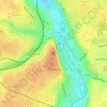
Nome: Mappa topografica Chartres Cathedral, altitudine, rilievo.
Altitudine media: 148 m
Altitudine minima: 123 m
Altitudine massima: 165 m
The elevation of the nave, showing the gallery on the ground level; the narrow triforium; and, on top, the windows of the clerestory