

Mappa topografica Forêt Montmorency
Clicca sulla mappa per visualizzare l'altitudine.
Forêt Montmorency
Located in the Laurentian Mountains, the Montmorency forest is drained by the Montmorency River and by one of its tributaries, the Black river. There are four lakes: Lac Piché, Bédard, Laflamme and Joncas. The altitude varies between 600 and 1,000 meters (3,300 ft) with an average of 750 meters. The predominant forest stand is the fir forest white birch.
A proposito di questa mappa
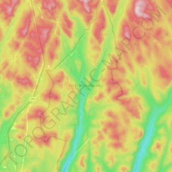
Nome: Mappa topografica Forêt Montmorency, altitudine, rilievo.
Altitudine media: 794 m
Altitudine minima: 497 m
Altitudine massima: 1.108 m
Altre mappe topografiche
Clicca su una mappa per visualizzarne la topografia, l'altitudine e il rilievo.
Mont Raoul-Blanchard
Canada > Quebec > La Côte-de-Beaupré > Lac-Jacques-Cartier
Altitudine media: 982 m