
Mappa topografica Kosjerić (town)
Mappa interattiva
Clicca sulla mappa per visualizzare l'altitudine.
Kosjerić (town)
Kosjeríć (Serbian Cyrillic: Косјерић, pronounced [kɔsjɛ̌rit͡ɕ]) is a town and municipality located in the Zlatibor District of western Serbia. The municipality has a population of 12,090 inhabitants, but the town itself has 3,992. The municipality's area is 359 square kilometres (139 sq mi), with 26 villages mostly placed in the river valleys, though there are also some settlements in the mountains at altitudes of more than 1,000 metres (3,300 feet).
A proposito di questa mappa
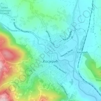
Nome: Mappa topografica Kosjerić (town), altitudine, rilievo.
Altitudine media: 465 m
Altitudine minima: 398 m
Altitudine massima: 695 m