
Mappa topografica Chester
Mappa interattiva
Clicca sulla mappa per visualizzare l'altitudine.
A proposito di questa mappa
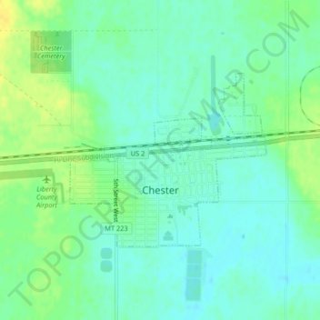
Nome: Mappa topografica Chester, altitudine, rilievo.
Luogo: Chester, Liberty County, Montana, 59522, United States (48.50549 -110.97888 48.52014 -110.95384)
Altitudine media: 959 m
Altitudine minima: 950 m
Altitudine massima: 972 m
Lake Elwell, 15 miles (24 km) southwest of Chester, offer opportunities for boating, skiing, camping, picnicking, and both freshwater fishing and ice fishing. Fishing and floating are also available on the Marias River downstream from Tiber Dam. The Sweet Grass Hills to the north are the highest elevation peaks east of Glacier Park within 30 miles (48 km) of Highway 2. Hunting for deer, antelope, game birds, and elk is popular in the fall.