
Mappa topografica Milburn
Mappa interattiva
Clicca sulla mappa per visualizzare l'altitudine.
A proposito di questa mappa
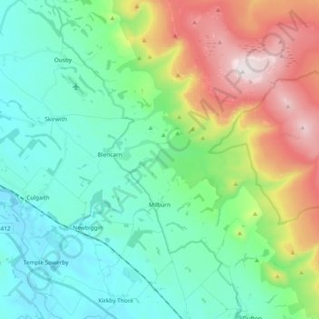
Nome: Mappa topografica Milburn, altitudine, rilievo.
Altitudine media: 320 m
Altitudine minima: 92 m
Altitudine massima: 893 m
Howgill Castle is a fortified manor house lying approximately 1 km to the east of the main village and at a slightly higher elevation. Butterworth believes that it dates from about 1340. It is defended to the north west by a deep ravine and commands extensive views. The original structure is more or less completely disguised by substantial 17th century modifications, but within the unremarkable shell created by this later work lie two three-storey towers, each 64 feet by 33 feet with walls about 9/10 feet thick connected by a wall over ten feet thick and over 40 feet long. This wall contains two superimposed flights of stairs providing communication between the towers. Originally, the ground floors of each tower were accessible only from the first floor. The position of the original entrance in this unusual scheme is unknown.