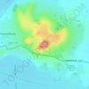
Mappa topografica Glastonbury Tor
Clicca sulla mappa per visualizzare l'altitudine.
Glastonbury Tor
The Tor is almost surrounded by the low-lying Somerset Levels, rising to an elevation of 518 feet (158 m). The Levels are reclaimed fen above which the Tor is clearly visible for miles around. It has been described as an island, but actually sits at the western end of a peninsula washed on three sides by the River Brue.
A proposito di questa mappa

Nome: Mappa topografica Glastonbury Tor, altitudine, rilievo.
Altitudine media: 33 m
Altitudine minima: 4 m
Altitudine massima: 148 m
Altre mappe topografiche
Clicca su una mappa per visualizzarne la topografia, l'altitudine e il rilievo.