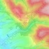
Mappa topografica Eisenach
Clicca sulla mappa per visualizzare l'altitudine.
Eisenach
Eisenach is at the northern edge of the Thuringian Forest, at an elevation of about 220 m. The terrain is hilly, and to the south also mountainous (up to 460 m of elevation), with the central Hörsel valley crossing the town in east–west direction. The Nesse river enters the Hörsel river in Eisenach after forming a valley through the spur of the Hörselberg mountains in the eastern municipal territory. The northern territory around the Neunkirchen, Stregda, and Hötzelsroda districts is relatively flat and in agricultural use. About 7 km (4 mi) west of the town centre runs the wide Werra valley, where the Hörsel river enters this bigger river near Hörschel district. The southern municipal territory is covered with forest, as are some smaller parts north of the Hörsel river. The Hainich mountains begin 10 km (6 mi) north-east of Eisenach.
A proposito di questa mappa
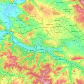
Nome: Mappa topografica Eisenach, altitudine, rilievo.
Luogo: Eisenach, Wartburgkreis, Thuringia, 99817, Germany (50.93081 10.17524 51.05239 10.39152)
Altitudine media: 298 m
Altitudine minima: 190 m
Altitudine massima: 468 m
Altre mappe topografiche
Clicca su una mappa per visualizzarne la topografia, l'altitudine e il rilievo.