
Mappa topografica State University of New York at Binghamton
Mappa interattiva
Clicca sulla mappa per visualizzare l'altitudine.
A proposito di questa mappa
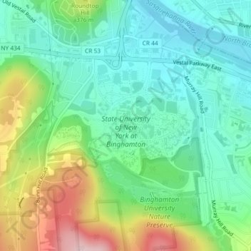
Nome: Mappa topografica State University of New York at Binghamton, altitudine, rilievo.
Altitudine media: 320 m
Altitudine minima: 246 m
Altitudine massima: 482 m
Altre mappe topografiche
Clicca su una mappa per visualizzarne la topografia, l'altitudine e il rilievo.
Kopernik Observatory & Science Center
United States > New York > Broome County > Town of Vestal > Tracy Creek
Kopernik Observatory & Science Center, 698, Underwood Road, Tracy Creek, Town of Vestal, Broome County, New York, 13850, United States
Altitudine media: 452 m
Ross Corners
United States > New York > Broome County > Town of Vestal
Ross Corners, Town of Vestal, Broome County, New York, United States
Altitudine media: 304 m