

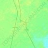
Mappa topografica Mahakali River
Clicca sulla mappa per visualizzare l'altitudine.
Mahakali River
The Sharda River is the downstream of Kāli River (or Mahakali River) that originates in the northern Uttarakhand state of India in the Great Himalayas on the eastern slopes of Nanda Devi massif, at an elevation of 3,600 m (11,800 ft) in the Pithoragarh district. It then flows on the Nepal and India border. Descending, it enters the Indo-Gangetic Plain at Brahmadev Mandi in Nepal, where it expands above the Sharda Barrage. From that point onward, it is known as the Sharda River. The river proceeds southeastward into India through northern Uttar Pradesh before merging with the Ghaghara River southwest of Bahraich, covering a distance of approximately 300 miles (480 km).
A proposito di questa mappa

Nome: Mappa topografica Mahakali River, altitudine, rilievo.
Altitudine media: 135 m
Altitudine minima: 130 m
Altitudine massima: 142 m
Altre mappe topografiche
Clicca su una mappa per visualizzarne la topografia, l'altitudine e il rilievo.
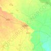
Lakhimpur
India > Uttar Pradesh > Lakhimpur
Lakhimpur is located at 27°57′N 80°46′E / 27.95°N 80.77°E / 27.95; 80.77. It has an average elevation of 147 metres (482 ft).
Altitudine media: 141 m