

Mappa topografica American River
Clicca sulla mappa per visualizzare l'altitudine.
American River
The North Fork is the longest tributary of the American River, at 88 miles (142 km). It begins at an elevation of about 7,900 feet (2,400 m) near Lake Tahoe in Placer County at Mountain Meadow Lake, just northeast of Granite Chief and immediately due west of Palisades Tahoe (formerly Squaw Valley) Ski Resort. It flows westward through remote wilderness areas.
A proposito di questa mappa
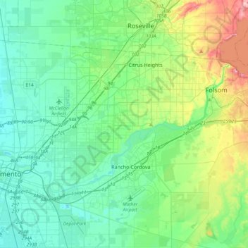
Nome: Mappa topografica American River, altitudine, rilievo.
Altitudine media: 44 m
Altitudine minima: 0 m
Altitudine massima: 197 m
Altre mappe topografiche
Clicca su una mappa per visualizzarne la topografia, l'altitudine e il rilievo.

Stone Creek Community Park
United States > California > Sacramento County > Rancho Cordova
Altitudine media: 33 m