
Fai una donazione
Preparati per la tua prossima avventura:
In qualità di associato Amazon, questo sito riceve una commissione sugli acquisti idonei senza alcun costo aggiuntivo per te.
Mappa topografica Askham Bog Nature Reserve
Clicca sulla mappa per visualizzare l'altitudine.
Fai una donazione
Preparati per la tua prossima avventura:
In qualità di associato Amazon, questo sito riceve una commissione sugli acquisti idonei senza alcun costo aggiuntivo per te.
Askham Bog Nature Reserve
However, subsequent colonization by common reed, whose fossilized root fragments have been found immediately above the nekron mud layer, lead to a reduced extent of open water. In turn, a layer of fen peat gradually accumulated above the mud in the bog centre to begin forming a raised bog. The increased elevation of the central peat mound began to cut off the direct influx of base-rich waters into the bog from the surrounding land and existing bases in the raised peat were leached out through rainfall. Therefore, net loss of bases from the peat in the centre of the bog gradually led to increased soil acidity, with loss of the original rich fen community which previously covered the whole area.
Fai una donazione
Preparati per la tua prossima avventura:
In qualità di associato Amazon, questo sito riceve una commissione sugli acquisti idonei senza alcun costo aggiuntivo per te.
A proposito di questa mappa
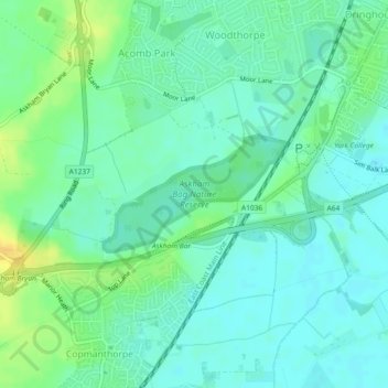
Nome: Mappa topografica Askham Bog Nature Reserve, altitudine, rilievo.
Altitudine media: 16 m
Altitudine minima: 7 m
Altitudine massima: 33 m
Fai una donazione
Preparati per la tua prossima avventura:
In qualità di associato Amazon, questo sito riceve una commissione sugli acquisti idonei senza alcun costo aggiuntivo per te.