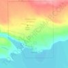
Mappa topografica Mackenzie River
Clicca sulla mappa per visualizzare l'altitudine.
Mackenzie River
The Mackenzie widens considerably to about 6 to 7 kilometres (3.7 to 4.3 mi) at Norman Wells, a major centre of oil production. There is a narrows at the Mountain River confluence called the Sans Sault Rapids, where the Mackenzie falls about 6 metres (20 ft). Below the Mountain River the Mackenzie flows due north until reaching The Ramparts, a limestone gorge barely 500 metres (1,600 ft) wide and up to 45 metres (148 ft) deep. Below The Ramparts is the village of Fort Good Hope, where the Mackenzie turns northwest again, soon crossing the Arctic Circle. The Mackenzie here flows slightly lower in elevation than the surrounding tundra, as a braided river between low bluffs about 3 to 5 kilometres (1.9 to 3.1 mi) apart. It receives the Arctic Red River from the southwest at Tsiigehtchic, where traffic on the Dempster Highway crosses via ferry/ice bridge.
A proposito di questa mappa

Nome: Mappa topografica Mackenzie River, altitudine, rilievo.
Altitudine media: 206 m
Altitudine minima: 32 m
Altitudine massima: 790 m
Altre mappe topografiche
Clicca su una mappa per visualizzarne la topografia, l'altitudine e il rilievo.