Mappa topografica Lichtenwald
Clicca sulla mappa per visualizzare l'altitudine.
Lichtenwald
The district of Hegenlohe lies on the wooded eastern slope (also called Heuberg by locals) of the Reichenbach valley and, like Thomashardt situated on the high ridge, is surrounded by the mixed forests of the Schurwald. The municipal area ranges from 342 to 480 meters in elevation.
A proposito di questa mappa
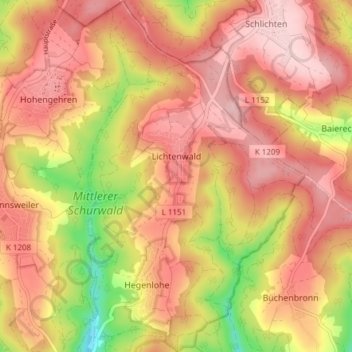
Nome: Mappa topografica Lichtenwald, altitudine, rilievo.
Altitudine media: 426 m
Altitudine minima: 288 m
Altitudine massima: 504 m
Altre mappe topografiche
Clicca su una mappa per visualizzarne la topografia, l'altitudine e il rilievo.


Ruine Reußenstein
Germany > Baden-Württemberg > Landkreis Esslingen > Neidlingen
Altitudine media: 675 m
Bernhausen
Germany > Baden-Württemberg > Landkreis Esslingen > Filderstadt > Bernhausen
Altitudine media: 382 m