

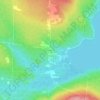
Mappa topografica Val-Racine
Clicca sulla mappa per visualizzare l'altitudine.
A proposito di questa mappa

Nome: Mappa topografica Val-Racine, altitudine, rilievo.
Luogo: Val-Racine, Le Granit, Estrie, Quebec, Canada (45.43759 -71.16252 45.56513 -71.01061)
Altitudine media: 558 m
Altitudine minima: 411 m
Altitudine massima: 1.102 m
Altre mappe topografiche
Clicca su una mappa per visualizzarne la topografia, l'altitudine e il rilievo.


Mont Gosford
Canada > Quebec > Le Granit > Saint-Augustin-de-Woburn
Since 1978, Mount Gosford is included in "ZEC Louise-Gosford", a controlled harvesting zone open to the public. Recently, the areas at more than 700 metres of altitude were designated Important Bird Areas due to the presence Bicknell's thrushes, an endemic species living in mountain peaks of northeast North…
Altitudine media: 933 m