
Mappa topografica Village of Cayuga Heights
Mappa interattiva
Clicca sulla mappa per visualizzare l'altitudine.
A proposito di questa mappa
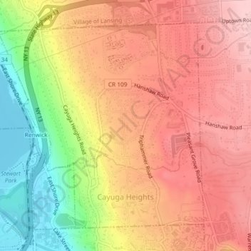
Nome: Mappa topografica Village of Cayuga Heights, altitudine, rilievo.
Altitudine media: 234 m
Altitudine minima: 114 m
Altitudine massima: 311 m
Cayuga Heights is located at 42°27′59″N 76°29′19″W / 42.466338°N 76.488678°W / 42.466338; -76.488678 (42.466338, -76.488678), on the eastern slope of Cayuga Lake. The elevation ranges from 900 feet near the Community Corners to 400 feet near the lake. Several streams and steep gorges cut through the village.