
Fai una donazione
Preparati per la tua prossima avventura:
In qualità di associato Amazon, questo sito riceve una commissione sugli acquisti idonei senza alcun costo aggiuntivo per te.
Mappa topografica Loch Tay
Clicca sulla mappa per visualizzare l'altitudine.
Fai una donazione
Preparati per la tua prossima avventura:
In qualità di associato Amazon, questo sito riceve una commissione sugli acquisti idonei senza alcun costo aggiuntivo per te.
Loch Tay
In the Early Medieval period people began to cultivate the higher elevations of the hills around the loch. The Macnabs, the Menzies, the Drummonds, the Napiers, the Haldanes, the MacGregors and the Robertsons of Carwhin and Strowan all owned land around the loch but little remains of their possible castles/manoors. Most of the surviving lordly residences are associated with the Glenorchy Campbells, who grew in power and influence during the 15th and early 16th centuries, specifically those at Lawers, Carwhin and Edramucky.
Fai una donazione
Preparati per la tua prossima avventura:
In qualità di associato Amazon, questo sito riceve una commissione sugli acquisti idonei senza alcun costo aggiuntivo per te.
A proposito di questa mappa
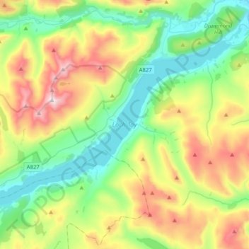
Nome: Mappa topografica Loch Tay, altitudine, rilievo.
Luogo: Loch Tay, Kenmore, Perth and Kinross, Scotland, United Kingdom (56.46929 -4.30815 56.58625 -3.99615)
Altitudine media: 460 m
Altitudine minima: 93 m
Altitudine massima: 1.204 m
Fai una donazione
Preparati per la tua prossima avventura:
In qualità di associato Amazon, questo sito riceve una commissione sugli acquisti idonei senza alcun costo aggiuntivo per te.