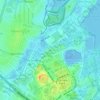
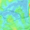
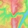
Mappa topografica Davidson
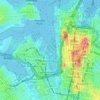
Clicca sulla mappa per visualizzare l'altitudine.
Davidson
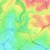
Davidson features uneven topography, in large part due to the area's origins as a mining quarry, as well as its proximity to Garigal National Park. Steep descents are evident in Stone Parade, Borgnis Street and Maitland Street, whereas more undulatory landscapes can be seen along parts of Prahran Avenue and Kambora Avenue.
A proposito di questa mappa

Nome: Mappa topografica Davidson, altitudine, rilievo.
Altitudine media: 98 m
Altitudine minima: 6 m
Altitudine massima: 178 m
Altre mappe topografiche
Clicca su una mappa per visualizzarne la topografia, l'altitudine e il rilievo.








St Leonards Park
Australia > New South Wales > Sydney > North Sydney
In 2018 it was announced that North Sydney Council would commence an upgrade of the park including improving the war memorial with a reflection pool, restoration of the Tunks Fountain and elevation on a new plinth, new benches, picnic tables, barbecues and drinking fountains, upgrades to lighting, additional…
Altitudine media: 61 m