
Mappa topografica Kota Samarahan
Mappa interattiva
Clicca sulla mappa per visualizzare l'altitudine.
A proposito di questa mappa
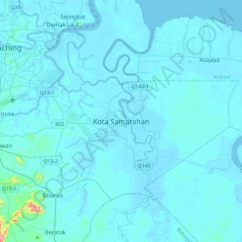
Nome: Mappa topografica Kota Samarahan, altitudine, rilievo.
Altitudine media: 9 m
Altitudine minima: -5 m
Altitudine massima: 304 m
On 19 August 1983, the Muara Tuang subdistrict was elevated to a full district status, and renamed as Samarahan District. In line with the status elevation, the Muara Tuang bazaar was elevated to a township, and renamed to Kota Samarahan.