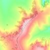
Mappa topografica Whitehorse
Clicca sulla mappa per visualizzare l'altitudine.
Whitehorse
Whitehorse has a subarctic climate (Köppen climate classification: Dfc, Trewartha Eclc) and lies in the rain shadow of the Coast Mountains, causing precipitation totals to be quite low year-round. Due to the city's location in the Whitehorse valley, the climate is milder than other comparable northern communities such as Yellowknife; however, during cold snaps it is not uncommon for temperatures to drop below −40 °C (−40 °F). With an average annual temperature of 0.2 °C (32.4 °F) Whitehorse is the warmest place in the Yukon. The temperature measurements for the city are taken at the airport. The Whitehorse Riverdale weather station situated at a lower elevation than the airport is also 0.2 °C (32.4 °F).
A proposito di questa mappa
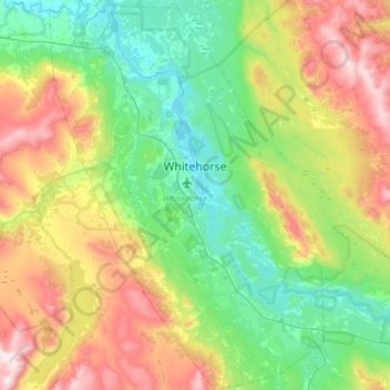
Nome: Mappa topografica Whitehorse, altitudine, rilievo.
Luogo: Whitehorse, Yukon, Canada (60.55364 -135.27872 60.84619 -134.85673)
Altitudine media: 1.007 m
Altitudine minima: 629 m
Altitudine massima: 1.857 m
Altre mappe topografiche
Clicca su una mappa per visualizzarne la topografia, l'altitudine e il rilievo.



Mount Logan
Due to active tectonic uplifting, Mount Logan is still rising in height (approximately 0.35 mm per year). Before 1992, the exact elevation of Mount Logan was unknown and measurements ranged from 5,959 to 6,050 metres (19,551 to 19,849 ft). In May 1992, a GSC expedition climbed Mount Logan and fixed the current…
Altitudine media: 5.292 m










Mount Steele
Mount Steele is the fifth-highest mountain in Canada and either the tenth- or eleventh-highest peak in North America. Its exact elevation is uncertain. Commonly-quoted figures are 5,073 metres (16,644 ft) and 5,020 metres (16,470 ft). A lower southeast peak of Mt. Steele stands at 4,300 m (14,100 ft).
Altitudine media: 4.446 m






Mount Logan
Mount Logan (/ˈloʊɡən/ LOH-ghən) is the highest mountain in Canada and the second-highest peak in North America after Denali. The mountain was named after Sir William Edmond Logan, a Canadian geologist and founder of the Geological Survey of Canada (GSC). Mount Logan is located within Kluane National Park…
Altitudine media: 5.292 m
Mount Logan
Mount Logan (/ˈloʊɡən/ LOH-ghən) is the highest mountain in Canada and the second-highest peak in North America after Denali (McKinley). The mountain was named after Sir William Edmond Logan, a Canadian geologist and founder of the Geological Survey of Canada (GSC). Mount Logan is located within Kluane…
Altitudine media: 5.292 m



Mount Logan
Due to active tectonic uplifting, Mount Logan is still rising in height (approximately 0.35 mm per year). Before 1992, the exact elevation of Mount Logan was unknown and measurements ranged from 5,959 to 6,050 metres (19,551 to 19,849 ft). In May 1992, a GSC expedition climbed Mount Logan and fixed the current…
Altitudine media: 5.292 m