
Mappa topografica Les Poulières
Mappa interattiva
Clicca sulla mappa per visualizzare l'altitudine.
Les Poulières
The commune is positioned between Épinal to the west and Saint-Dié to the north-east, in the valley of the Neuné, a tributary of the Vologne River. Neighbouring communes are Biffontaine and La Chapelle-devant-Bruyères. Les Poulières is at the confluence of several roads, but roads here are small and twisting, thanks to the topography, on the western fringes of the Vosges Mountains.
A proposito di questa mappa
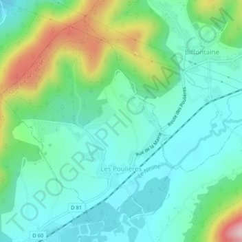
Nome: Mappa topografica Les Poulières, altitudine, rilievo.
Altitudine media: 510 m
Altitudine minima: 438 m
Altitudine massima: 709 m