
Fai una donazione
Preparati per la tua prossima avventura:
In qualità di associato Amazon, questo sito riceve una commissione sugli acquisti idonei senza alcun costo aggiuntivo per te.
Mappa topografica Indian Springs
Clicca sulla mappa per visualizzare l'altitudine.
Fai una donazione
Preparati per la tua prossima avventura:
In qualità di associato Amazon, questo sito riceve una commissione sugli acquisti idonei senza alcun costo aggiuntivo per te.
Indian Springs
One year later, Indian Springs was reactivated as Indian Springs Air Force Base by the new United States Air Force, with a new role as a new weapons systems and aircraft research and testing. Among these missions were support for nuclear arms testing at the Nevada Proving Grounds, high-altitude balloon search and retrieval, new gunnery and rocketry systems, and testing of experimental aircraft. For a period of the 1950s and 1960s Indian Springs AFB housed some of the most advanced aircraft and air weapons systems in the world.
Fai una donazione
Preparati per la tua prossima avventura:
In qualità di associato Amazon, questo sito riceve una commissione sugli acquisti idonei senza alcun costo aggiuntivo per te.
A proposito di questa mappa
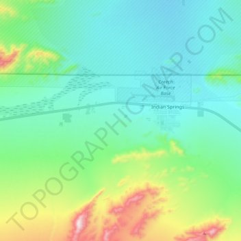
Nome: Mappa topografica Indian Springs, altitudine, rilievo.
Luogo: Indian Springs, Clark County, Nevada, United States (36.54362 -115.80646 36.59616 -115.63600)
Altitudine media: 1.078 m
Altitudine minima: 930 m
Altitudine massima: 1.592 m
Fai una donazione
Preparati per la tua prossima avventura:
In qualità di associato Amazon, questo sito riceve una commissione sugli acquisti idonei senza alcun costo aggiuntivo per te.