
Mappa topografica Glasgow
Mappa interattiva
Clicca sulla mappa per visualizzare l'altitudine.
A proposito di questa mappa
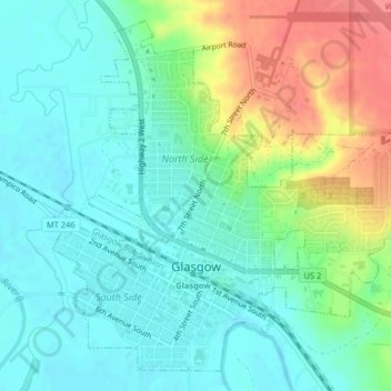
Nome: Mappa topografica Glasgow, altitudine, rilievo.
Luogo: Glasgow, Valley County, Montana, 59230, United States (48.18836 -106.65042 48.21255 -106.61272)
Altitudine media: 654 m
Altitudine minima: 633 m
Altitudine massima: 700 m
According to the United States Census Bureau, the city has a total area of 1.43 square miles (3.7 km2), all of it land. The town has an elevation of 2,093 feet (638 m) and is nestled in the Milk River Valley.