

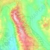
Mappa topografica Mount Huntington
Clicca sulla mappa per visualizzare l'altitudine.
A proposito di questa mappa
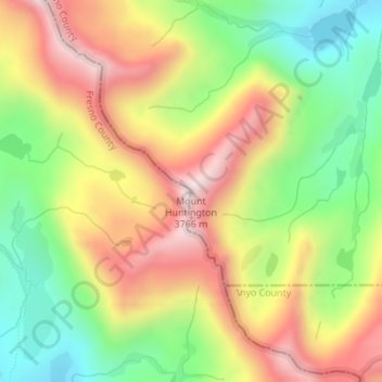
Nome: Mappa topografica Mount Huntington, altitudine, rilievo.
Luogo: Mount Huntington, Mono County, California, United States (37.46974 -118.77741 37.46984 -118.77731)
Altitudine media: 3.444 m
Altitudine minima: 3.150 m
Altitudine massima: 3.759 m
Altre mappe topografiche
Clicca su una mappa per visualizzarne la topografia, l'altitudine e il rilievo.


June Lake
United States > California > Mono County > June Lake
Because the community is built on hills and meadows in this subalpine valley surrounded by high mountain peaks, it has been dubbed the "Switzerland of California." The area is notable for its trout fishing. Hiking is a favorite pastime of the area: June Lake offers many trails that lead into the nearby back…
Altitudine media: 2.531 m


Mammoth Lakes
United States > California > Mono County
Mammoth Lakes is a town in Mono County, California, and is the county's only incorporated community. It is located immediately to the east of Mammoth Mountain, at an elevation of 7,880 feet (2,400 m). As of the 2020 United States Census, the population was 7,191, reflecting a 12.7% decrease from the 2010…
Altitudine media: 2.682 m

Bridgeport
United States > California > Mono County > Bridgeport
Bridgeport is in northwestern Mono County and lies at an elevation of 6,463 feet (1,970 m) in the middle of the Bridgeport Valley. The valley is ringed by mountains with the Sierra Nevada to the west, the Sweetwater Mountains to the north, and the Bodie Hills to the east.
Altitudine media: 2.074 m
Mammoth Lakes
United States > California > Mono County
Mammoth Lakes is the only incorporated town in Mono County, California, United States. It is located immediately to the east of Mammoth Mountain, at an elevation of 7,880 feet (2,400 m). As of the 2020 United States census, the population was 7,191, reflecting a 12.7% decrease from the 2010 Census.
Altitudine media: 2.682 m
Mammoth Lakes
United States > California > Mono County
Mammoth Lakes is the only incorporated town in Mono County, California, United States. It is located immediately to the east of Mammoth Mountain, at an elevation of 7,880 feet (2,400 m). As of the 2020 United States census, the population was 7,191, reflecting a 12.7% decrease from the 2010 Census.
Altitudine media: 2.682 m
June Lake
United States > California > Mono County > June Lake
June Lake is a census-designated place in Mono County, California. It is located against the southern rim of the Mono Basin, 12.5 miles (20 km) south of Lee Vining, at an elevation of 7654 feet (2333 m).
Altitudine media: 2.445 m
Mono Lake
United States > California > Mono County
Lake Russell was the prehistoric predecessor to Mono Lake, during the Pleistocene. Its shoreline reached the modern-day elevation of 7,480 feet (2,280 m), about 1,100 feet (330 m) higher than the present-day lake. As of 1.6 million years ago, Lake Russell discharged to the northeast, into the Walker River…
Altitudine media: 2.008 m
Mammoth Lakes
United States > California > Mono County
Mammoth Lakes is a town in Mono County, California, and is the county's only incorporated community. It is located immediately to the east of Mammoth Mountain, at an elevation of 7,880 feet (2,400 m). As of the 2020 United States Census, the population was 7,191, reflecting a 12.7% decrease from the 2010…
Altitudine media: 2.682 m
Mammoth Lakes
United States > California > Mono County
Mammoth Lakes is a town in Mono County, California, and is the county's only incorporated community. It is located immediately to the east of Mammoth Mountain, at an elevation of 7,880 feet (2,400 m). As of the 2020 United States Census, the population was 7,191, reflecting a 12.7% decrease from the 2010…
Altitudine media: 2.682 m
Bridgeport
United States > California > Mono County > Bridgeport
Bridgeport is in northwestern Mono County and lies at an elevation of 6,463 feet (1,970 m) in the middle of the Bridgeport Valley. The valley is ringed by mountains with the Sierra Nevada to the west, the Sweetwater Mountains to the north, and the Bodie Hills to the east.
Altitudine media: 2.074 m
