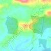
Mappa topografica Beerwah
Clicca sulla mappa per visualizzare l'altitudine.
A proposito di questa mappa

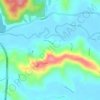
Nome: Mappa topografica Beerwah, altitudine, rilievo.
Altitudine media: 55 m
Altitudine minima: 2 m
Altitudine massima: 388 m
Altre mappe topografiche
Clicca su una mappa per visualizzarne la topografia, l'altitudine e il rilievo.
Sunshine Coast
Australia > Queensland > Sunshine Coast Regional
The Sunshine Coast in Queensland, Australia, showcases a diverse topography that harmoniously blends coastal plains with rugged hinterlands. Along its eastern edge, the region features expansive sandy beaches and coastal dunes that transition smoothly into fertile lowlands. Inland, the terrain becomes more…
Altitudine media: 109 m










Caloundra
Australia > Queensland > Sunshine Coast Regional
Caloundra, located on Queensland's Sunshine Coast, features a diverse coastal topography characterized by sandy beaches, rocky headlands, and nearby elevated terrains. The suburb of Kings Beach exemplifies this diversity, with its sandy shoreline to the south and southeast, and a rocky headland rising to about…
Altitudine media: 5 m