
Mappa topografica Poughkeepsie
Mappa interattiva
Clicca sulla mappa per visualizzare l'altitudine.
A proposito di questa mappa
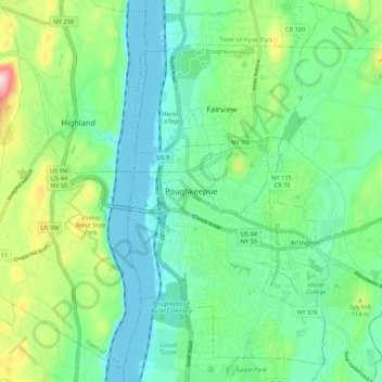
Nome: Mappa topografica Poughkeepsie, altitudine, rilievo.
Altitudine media: 65 m
Altitudine minima: -8 m
Altitudine massima: 241 m
According to the United States Census Bureau, the city has an area of 5.7 square miles (14.8 km2), of which 5.1 square miles (13.3 km2) is land, and 0.23 square miles (0.6 km2) (10.05%) is water. Poughkeepsie lies approximately 75 miles (121 km) north of the center of the New York megacity. It is 73.5 miles (118.28 km) south of the New York state capital of Albany. The highest elevation of Poughkeepsie is 380 feet above sea level on College Hill. Its lowest is on the Hudson River.